More Puna residents advised to evacuate as lava advances


HAWAIIAN VOLCANO OBSERVATORY / USGS
Crews made visual observations of activity at fissure 8 around 5:30 a.m. today. Fountain heights this morning continue to reach 230 to 260 feet above ground level. The fountaining is feeding a lava flow that is moving to the northeast along Highway 132 into the area of Noni Farms Road.

DENNIS ODA / DODA@STARADVERTISER.COM
Night view, Wednesday, of the lava eruption from fissure 8 from Luana St. in Leilani Estates.

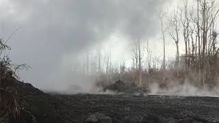
U.S. GEOLOGICAL SURVEY
This is an outbreak of Pahoehoe lava that was very rapidly moving north down Luana Street into a portion of Leilani Estates as searchers attempted to evacuate a resident who was about to be stranded by the fast-moving flow, near Pahoa.

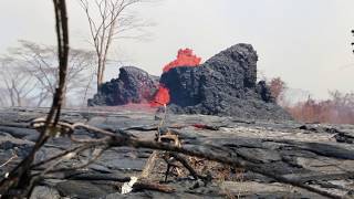
DENNIS ODA / DODA@STARADVERTISER.COM
A large fountain of lava from fissure 8 was seen, Tuesday, from the end of Luana St. in Leilani Estates in Puna.

DENNIS ODA / DODA@STARADVERTISER.COM
The National Guard took the media out on a tour of the lava sites in Leilani Estates. Jeff Hickman, public affairs officer for Hawaii National Guard, stood in front of fissure 7, Sunday, on Leilani Ave. talking about the dangers of getting too close to the lava flow. He said this is as close to the eruption that we could go to be safe. Air quality conditions indicated it was completely safe.

DENNIS ODA / DODA@STARADVERTISER.COM
Lava from fissure 8 flowed over Pohoiki Road, Monday, between Leilani Estates and the Puna geothermal plant. A USGS scientist and national guardsman walked toward the flow to check the air quality.

DENNIS ODA / DODA@STARADVERTISER.COM
Highway 132 near Pohoiki Road past Pahoa was closed Tuesday morning due to lava.

U.S. GEOLOGICAL SURVEY
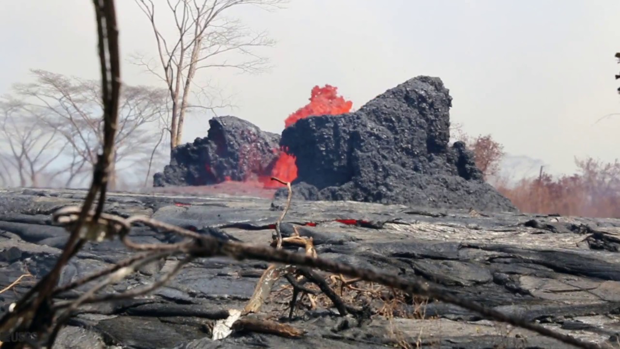
Lava encroached on Highway 132 on Tuesday.


UPDATE: 7:15 a.m.
Lava from several fissures continues to move through Leilani Estates, Lanipuna Gardens and towards the Kapoho area, according to Hawaii County Civil Defense.
A fast-moving flow near Noni Farms Road is heading toward the Waa Waa area, the Hawaii County Fire Department said.
“Residents of Government Beach Road, Kapoho Beach Lots and Vacationland area at risk for isolation or lava inundation should a flow reach that area and are advised to evacuate due to the possibility,” Civil Defense said.
>> Scientists debate whether Leilani eruption is ‘new’
>> Pahoa man, 61, charged with armed robbery after shots fired in Leilani Estates video
>> Lava scientists’ drone guides lost resident through jungle
>> Lawmaker wants emergency orders to help house lava evacuees
>> More Puna residents advised to evacuate as lava advances
>> State cites lava gawkers who bypass security checkpoints
>> Puna man ‘just wanted to live’ after nearly losing leg to lava bomb
RELATED PHOTOS AND VIDEOS
>> Live webcams from Hawaii island
>> Hawaii Fire Department tracks lava from the air, May 30
>> Aerial view of lava flow in Leilani Estates, May 29
>> No break over holiday weekend for Kilauea, May 28
>> Victor Hoapili talks as lava fountains erupt in his backyard
>> Ken Szymanski talks about lava fissures in his neighborhood
Don't miss out on what's happening!
Stay in touch with top news, as it happens, conveniently in your email inbox. It's FREE!
COMPLETE KILAUEA COVERAGE
>> Star-Advertiser volcano coverage
>> Kilauea Volcano YouTube playlist
6 a.m.
Overflows from the west side of the fissure 8 flow at Makamae Street in Leilani Estates moved north and crossed Kahukai Street as part of a small breakout early this morning.
Lava was filling a low area at the intersection of Makamae and Kahukai streets, the Hawaiian Volcano Observatory said in an online post at 3 a.m.
Fissure 8 was continuing to spout eruptive fountains of lava up to 250 feet as of 10 p.m., HVO said. The fountaining continues to feed a lava flow moving north out of Leilani Estates and northeast along Highway 132 into the Noni Farms Road area. However, the flow front had slowed to less than 50 yards per hour.
WEDNESDAY, MAY 30
6 p.m.
Lava from several fissures continues to move through Leilani Estates, Lanipuna Gardens and towards the Kapoho area.
Residents of Kapoho Beach Lots and Vacationland are advised to evacuate due to the possibility of lava cutting off access to Beach Road near Four Corners.
Civil Defense reports one lava flow is approximately two-and-a-half miles from Four Corners and a second is about a half-a-mile from Highway 137, north of Ahalanui County Park.
Due to the volcanic activity the following policies are in effect:
>> Beach Road, from Four Corners to Hawaiian Beaches, is restricted to resident access only, between 7 a.m. to 6 p.m., to allow continued evacuations.
>> Highway 132 is closed.
>> Leilani Estates residents with approved credentials are allowed to enter at 7 a.m. but must leave by 6 p.m. This curfew is strictly enforced for your safety. A mandatory evacuation is in effect past Pomaikai Street.
>> Residents close to any volcanic activity should remain alert and be prepared to voluntarily evacuate if necessary.
Kilauea Lower East Rift Zone Fissures and Flows, May 30 by Honolulu Star-Advertiser on Scribd
Map details shown here are accurate as of the date/time noted. Shaded purple areas indicate lava flows erupted in 1840, 1955, 1960, and 2014-2015. (see large map)
PREVIOUS COVERAGE
HILO >> Crews began work today on opening an emergency evacuation route for Lower Puna on the Chain of Craters Road and should be able to complete that that work in about a week or two, according to a spokeswoman for the Hawaii Volcanoes National Park.
That news comes hours after the hottest lava yet in the current eruption from Kilauea volcano emerged from a fissure in Leilani Estates subdivision and raced northeast down a slope toward the sea, moving at speeds that at times reached 600 yards per hour early this morning.
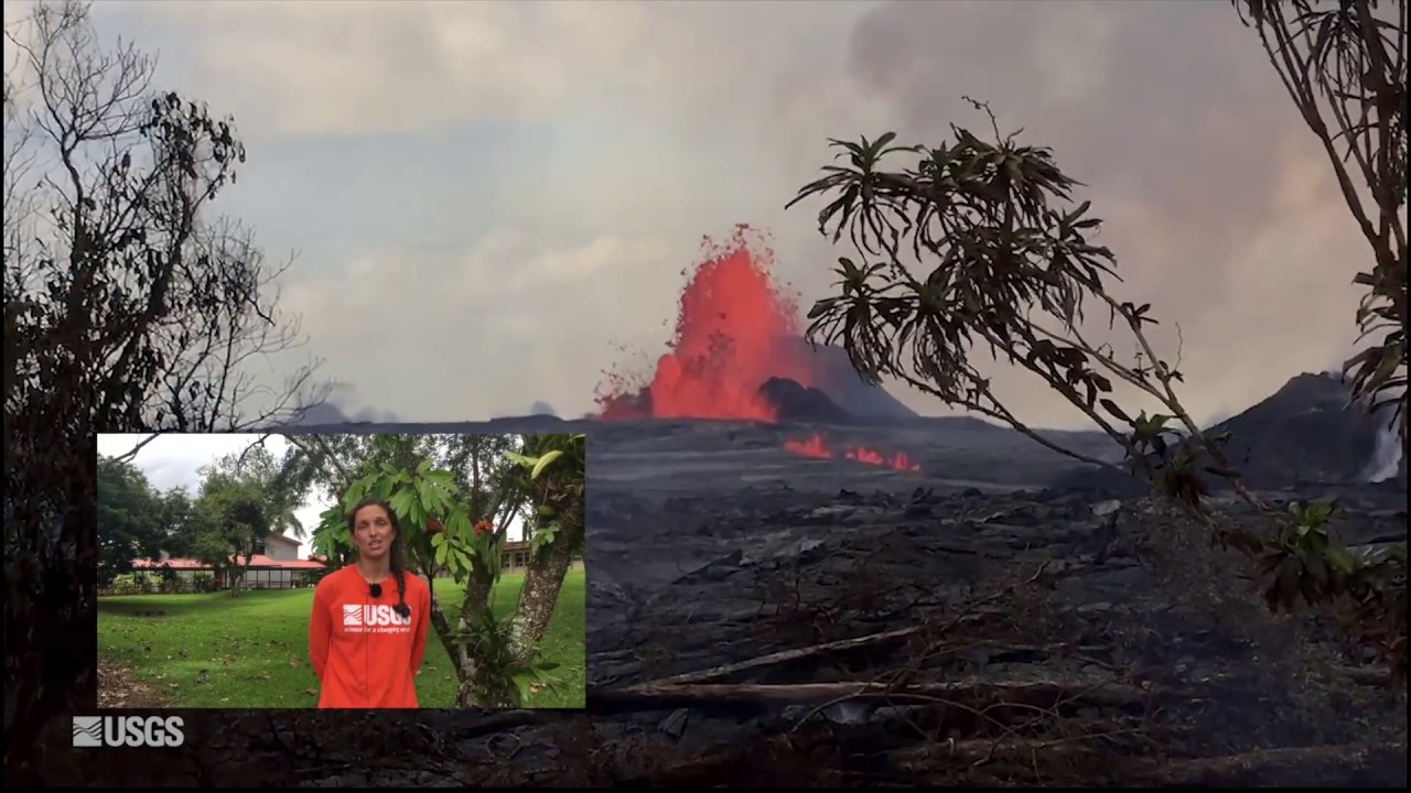
That rate of advancement for lava is “very fast for this type of flow,” said Wendy Stovall, a U.S. Geological Survey volcanologist. “This one is different because it’s not flowing south and downslope, and it kind of followed the highway instead of taking the path of steepest descent from our projected models….Those were all surprises.”
Lava flows from several fissures continue to advance toward the Kapoho area, according to Hawaii County Civil Defense. They are estimated to be less than half a mile from Highway 137.
A light earthquake also struck the Kilauea summit area of Hawaii island this morning but did not pose a tsunami threat.
The magnitude 4.5 quake struck at 10:55 a.m. at a depth of three-quarters of a mile and was centered 3.7 miles southwest of Volcano, according to the U.S. Geological Survey.
“No tsunami is expected,” the Pacific Tsunami Warning Center said in a bulletin. “However, some areas may have experienced shaking.”
By 6 a.m. this morning, that flow was about two miles from the intersection of Highways 132 and 137, an intersection known locally as the Four Corners. If the flow crosses Highway 137 as it appears to be poised to do, it would completely cut off access to the subdivisions in the area.
The leading edge of that lava flow slowed somewhat later this morning, she said, but reports from the field indicate fissure 8 that produced the flow “is doing exactly what it’s been doing for essentially the past 12 hours — fountaining heights are high, above 200 feet, and there just no sign of waxing or waning in that fountain itself.”
The evacuation area in Lower Puna was abruptly expanded in response to the rapidly moving flow early this morning to include the coastal subdivisions of Vacationland and Kapoho Beach Lots.
Police went door-to-door in those subdivisions in the early morning hours to warn residents that if they did not leave immediately, they could become isolated if lava crossed Highway 137 near the ocean.
County Department of Public Works crews helped residents to move their belongings in an operation that was completed at about 2:30 a.m., said county spokeswoman Janet Snyder.
The one-lane rural route designated as Highway 137 was converted into a one-way route out of the Lower Puna area to ease the flow of evacuation traffic.
Snyder was unable to say how many people were evacuated overnight. A total of 341 people were gathered at three Puna emergency shelters this morning, but many of those residents were evacuated from Leilani Estates and other parts of Puna earlier in the month.
Many of the homes in the Vacationland and Kapoho Beach Lots are used as vacation rentals, and county officials have been warning residents of the area for more than a week to be prepared to evacuate on very short notice.
“The area is now closed off, and it is for residents only getting out,” Snyder said.
Staff were added to the two county-run shelters at Pahoa Community Center and Keaau Community Center, she said.
Fissure 18 was also highly active this morning and was feeding one lava flow reaching to within about a half-mile of the famous coastal warm pond at Ahalanui, and another extending its reach to about a mile from the Four Corners intersection, which is a critical access point for Highway 137.
State and county officials have scheduled public meetings for 5:30 p.m. tonight at the Robert N. Herkes Gymnasium and Shelter in Kau, and at the Pahoa Intermediate and High School cafeteria in Pahoa at 5 p.m. on Tuesday.
So far the Lower East Rift eruption that began May 3 has destroyed 75 homes.


