Lava flow from Mauna Loa eruption less than 2 miles from key highway


1/6
Swipe or click to see more
VIDEO COURTESY USGS
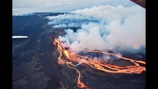
Watch a live webcam video of the Mauna Loa eruption from Fissure No. 3.
2/6
Swipe or click to see more
COURTESY USGS
This is a screenshot from the live web cam of Fissure No. 3 from the Mauna Loa eruption. This was taken 11:11 a.m. Dec. 6.
3/6
Swipe or click to see more
COURTESY USGS
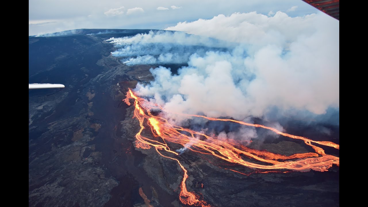
This aerial image taken the morning of Dec. 5 shows Fissure No. 3 from the Mauna Loa's northeast rift zone with lava fountains reaching 130 feet high, with bursts over 330 feet.4/6
Swipe or click to see more
COURTESY USGS
This image taken midday Dec. 5 during a helicopter overflight of Mauna Loa's eruption, shows a lava flow branching off after cutting across the Mauna Loa Access Road.5/6
Swipe or click to see more
COURTESY USGS
This is a close-up view of Fissure No. 3 lava channel erupting from Mauna Loa's northeast rift zone on the morning of Dec. 5.6/6
Swipe or click to see more
COURTESY USGS
Views and and field observations of Mauna Loa's northeast rift zone have been hampered by poor visibility. This photo was taken when the flanks of Mauna Loa were visible from the road, but clouds obscured the view a few minutes later.
Saint Louis beats Kamehameha in ILH baseball

Lahaina Strong urges passage of short-term rentals bill

Greece’s capital turns an orange hue with dust clouds from North Africa

2 Malaysian military helicopters collide, killing all 10 crew

UH baseball team wins over Cal Poly with 6-5 victory

People attend plant giveaway with more than 1,000 plants

Israeli strikes on southern Gaza city of Rafah kill 22

Back in the Day: Photos from Hawaii’s Past

Long Beach State beats UC Irvine for Big West men’s volleyball title
Subscriber Favorites
UH men’s basketball associate head coach joins Long Beach State
Man lying on Nuuanu Ave. critically hurt after being struck by vehicle
Tabloid publisher pledged to be ‘eyes and ears’ for Trump’s 2016 campaign
Honolulu police arrest 5 attempting to hike up Haiku Stairs
New federal rule would bar ‘noncompete’ rules for most employees
More Photo Galleries
Saint Louis beats Kamehameha in ILH baseball
Lahaina Strong urges passage of short-term rentals bill
Greece’s capital turns an orange hue with dust clouds from North Africa

2 Malaysian military helicopters collide, killing all 10 crew
UH baseball team wins over Cal Poly with 6-5 victory


