Weekend could bring vog, rain, dangerous surf to east shores
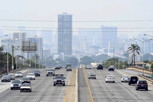
The vog that rolled in Sunday morning is expected to linger into next weekend, according to the National Weather Service. “Towards the end of the workweek, the haze might go away from Maui County and the northeastern part of the Big Island, but it’ll probably stay over Kauai and Oahu into the weekend,” said Tim Craig, a senior forecaster for the agency. Craig said high clouds over Oahu could dissipate today but will return Tuesday. Oahu is expected to be cloudy but dry for most of the week, while showers could be prevalent on Hawaii island and Kauai early in the week, he said. Above, vog swathed Honolulu on Sunday in a west-looking perspective from Koko Head Avenue above the H-1 freeway.
A change in the weather could bring light winds and low scores for golfers at the Sony Open, a hazy, humid and wet weekend, the chance of snow on Hawaii island summits and large, potentially dangerous surf to east shores.
National Weather Service forecasters say an approaching cold front will block the northeast tradewinds starting today, leaving us with light, variable winds, mostly from the south.
Those winds may bring up vog from Kilauea and humidity from the south Saturday through Monday, creating hazy and muggy conditions.
The unstable weather and daytime heating over the land could create afternoon clouds and showers for leeward and mountain slopes, and possibly thundershowers on Hawaii island and Maui.
Heavy rain fell Thursday evening over Hawaii island, prompting a flood advisory until 7:45 p.m. between Waikii and Puuanahulu, including Waikoloa Village.
In addition, cold and wet conditions in the upper atmosphere may bring, freezing rain or fog and sporadic snow to Mauna Kea and Mauna Loa.
Don't miss out on what's happening!
Stay in touch with breaking news, as it happens, conveniently in your email inbox. It's FREE!
Strong northeast winds east of the islands are also creating large surf that should peak Friday night into Saturday morning for east shores. Forecasters expect waves of between 7 to 10 feet through Saturday morning.
Tom Birchard, a forecaster with the National Weather Service Honolulu office, said the swell and an unusually large high tide Saturday morning could see surf wash over Kamehameha Highway near Kaaawa on Saturday.
The cooling trade winds will gradually diminish Friday, which should be good news for golfers at the Sony Open. Light, variable winds of 5 to 15 mph are predicted through Monday. The winds will blow from the land at night and in the early morning, shifting to sea breezes in the afternoon as the weather gets warmer.
"It will be quite different from last week when the golfers on Maui saw the high winds," Birchard said. "The winds will be light this week. The golfers wil lhave experienced the full range of our Hawaiian weather."
Light trade winds should return Tuesday when the cold front passes through the islands.


