Front bringing vog, light winds, rains
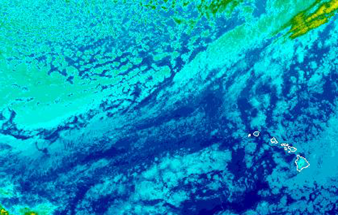
A weak front approaching the islands from the north and northwest is bringing a change in Hawaii's weather.
A weak front approaching the islands from the northwest is expected to bring vog, light winds and rain to the islands.
Light winds are starting to turn southwesterly, bringing volcanic haze to Oahu by Thursday afternoon.
A few showers ahead of the front began falling on Oahu Wednesday. The front is expected to move down the island chain and reach the Big Island by Friday.
“It’s not a very strong front, but there’s going to be an increase in clouds and a chance of some light shower activity,” said Chevy Chevalier, a meteorologist with the National Weather Service Honolulu office.
The forecast for Honolulu and southern shores of Oahu calls for isolated showers and mostly sunny skies Wednesday. There’s a 50 percent chance of rain Thursday night.
Light northerly winds and cooler temperatures are expected after the front passes. A slight chance of rain continues through Sunday, when tradewinds are expected to return.
Don't miss out on what's happening!
Stay in touch with breaking news, as it happens, conveniently in your email inbox. It's FREE!
But another front could bring more rain to the state early next week.
A high surf advisory is also in effect for north- and west-facing shores of Niihau, Kauai, Oahu and north-facing shores of Molokai and Maui until 6 a.m. Thursday.
Forecasters said the surf could reach between 12 and 18 feet for all north- and west-facing shores of Oahu, Niihau and Kauai and between 8 to 14 feet for all west-facing shores of Maui and Molokai.


