Scrutiny of Kaukonahua Stream grows after the devastating North Shore flooding

JAMM AQUINO / JAQUINO@STARADVERTISER.COM
Community leader Levi Rita looked out at flood-ruined homes Wednesday along Haona Street in Waialua.

JAMM AQUINO / JAQUINO@STARADVERTISER.COM
Hundreds of community members have rallied to help residents who have lost their homes and belongings during the devastating Kona-low storm systems as cleanup efforts continue.

COURTESY BRUSKI LOUIS
A drone photograph taken Wednesday shows a landslide caused by the Kona-low rains and flooding in Waialua.

JAMM AQUINO / JAQUINO@STARADVERTISER.COM
Homes in Waialua’s Otake Camp were destroyed during the recent storms.

JAMM AQUINO / JAQUINO@STARADVERTISER.COM
Kaupe Road resident Briana Grilho described the water level while looking out at the upper bridge of Kaukonahua Stream Wednesday in Waialua.
As muddy water tore through homes along Kaupe Road last weekend, residents say the disaster felt both sudden and long in the making — a crisis fueled not just by a powerful Kona-low storm, but by years of neglect and fragmented responsibility along the Kaukonahua Stream.
Families who have lived for generations along the waterway describe a system choked with debris, tangled in jurisdictional confusion and left without consistent maintenance — conditions they say turned a severe storm into a near-deadly event.
“We could’ve died,” said Briana Grilho, crying as she recalled the night floodwaters surged through her family’s property. “We were not prepared for anything like this.”
Grilho has lived for 8 years in a home passed down through generations, and said the experience was unlike anything her family has ever seen.
“It was so traumatic,” she said. “My (7-year-old) son literally floated in the floodwater.”
The flooding began late March 19 as intense rainfall overwhelmed waterways across Oahu’s North Shore. But residents and local leaders say the scale of destruction — homes washed off foundations, families displaced — was intensified by long-standing maintenance issues.
Don't miss out on what's happening!
Stay in touch with breaking news, as it happens, conveniently in your email inbox. It's FREE!
“There’s just so much debris — debris coming down from the mountains, from everywhere, and it clogs all the water under the bridge,” Grilho said.
Community members pointed to sediment buildup, overgrown vegetation and large debris obstructing flow — particularly beneath bridge crossings — as key factors that worsened flooding.
The problem, they say, is compounded by a confusing patchwork of ownership.
“It makes it complicated because the jurisdictions are different,” Grilho said. “But when it’s a state emergency, somebody, everybody needs to take action.”
The Kaukonahua Stream flows through a maze of ownership: segments managed by the City and County of Honolulu, the state Department of Transportation’s Farrington Highway bridge crossing, privately owned bridges and parcels, and upstream military lands. Even within a small stretch behind T. Otake & Sons, land is divided among multiple owners, including the Otake family, private individuals and the Achiu family property where Grilho lives.
That fragmentation, residents say, has led to gaps in upkeep — and ultimately, accountability.
Honolulu City Council Chair Tommy Waters will hold an informational briefing before the Executive Management Committee on Wednesday, focused on establishing facts, timelines, accountability, outcomes and future support systems following the Kona-low storms.
“When disaster strikes, the government’s response should be immediate, coordinated, and effective. The city has disaster preparedness plans, emergency response agencies, and recovery systems built precisely for this moment,” Waters said in an email to the Honolulu Star-Advertiser. “The Council’s job is to identify what worked, what failed, and what must change. If laws, policies, or agency protocols are slowing recovery, the Council would like to understand from the departments how they can act to address and potentially improve the city’s response so that next time, families get faster and stronger support.”
For Bruski Louis, who joined neighbors in rescuing trapped residents and clearing debris with heavy equipment, the disaster exposed systemic failures.
“This was a pure example of mismanagement,” he said.
Louis described how emergency access quickly broke down as floodwaters overtook roads and bridges. The Waialua fire station was flooded early, cutting off one of the closest response units, while crews from Wahiawa and Mililani had difficulty reaching the area as bridges became impassable.
“We were literally stuck in the North Shore. Everybody was stuck on the North Shore and we couldn’t go anywhere,” Louis said. “We just worked — the community did not stop.”
Rescue efforts stretched into Friday late night — largely driven by residents themselves.
“As a community, and based on what we’ve seen in the past, we know we can’t rely on (government agencies), and we have to rely on ourselves,” he said. “We just have to pull through and do it. We all saw it in Lahaina, so here, as a community, we’re not going to let that happen to our beautiful hometown.”
Still, Louis acknowledged shared responsibility.
“We can’t blame one person, or the state, the city, the military, the farmers,” he said. “It’s all our fault. And now we just have to go from there.”
During plantation days
Longtime resident Wendell Toki, 65, said the Kaukonahua Stream once ran clear and manageable — especially during the plantation era, when private agricultural operators actively maintained waterways.
“It was normal when the plantation was running. It was doing the job,” he said. “After Dole gave up, it just … we have floods but never like this.”
Residents including Toki and Louis said earlier generations had pushed for dredging and upkeep decades ago — requests they say went unanswered.
“A lot of the rivers were managed before,” Louis said, recalling conversations with kupuna who grew up swimming in the stream decades ago. “They said they asked the state to dredge this stream 20 years ago, and nobody came.”
City and state officials say that complexity is not unique to Kaukonahua — but it does complicate response and maintenance.
“That is rather complicated,” Honolulu Department of Emergency Management Director Randal Collins said. “The dam itself is owned by Dole … but as you go down the river stream, there could be any number of public and/or private owners in different segments.”
Collins said coordination does occur — including regular planning, dam safety exercises and real-time communication during storms — but authority is limited.
“The problem is we can’t direct private owners to really do anything,” he said. “It’s our expectation that they keep it clean.”
That limitation, he said, points to a larger policy gap.
“I think one thing that we’ll have to look at in the future are statute changes … to really provide a better mechanism to know who’s responsible for what and enforce that,” Collins said.
State Department of Transportation Director Ed Sniffen, who visited the site in the days after the destructive flooding, acknowledged major blockages in the stream.
“When we started looking at these areas, we saw a lot of restrictions in the stream,” he said, describing sediment and debris buildup beneath bridges. “The whole bay on one side is blocked up with … silt that came down from the storm.”
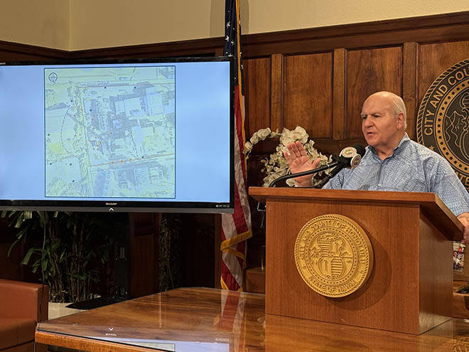
Crews have begun clearing debris and mapping the stream using drones to identify problem areas and develop a long-term maintenance plan.
Sniffen said the storm overwhelmed infrastructure designed for “100-year” events, particularly given back-to-back storms and saturated ground conditions.
“The drainage systems were overwhelmed by the flow,” he said, also noting the cost of systemwide upgrades could reach billions of dollars.
Still, he said improvements are needed — including better coordination and communication with communities.
Within the flood zone
City officials say the devastation along Kaukonahua Stream is also tied to a long-standing reality: much of the area sits within designated flood zones, where risk is known but not always mitigated.
Honolulu’s Department of Planning and Permitting said many of the impacted homes were built before modern flood regulations were adopted and are considered “nonconforming” under current standards.
The city joined the National Flood Insurance Program in 1980, establishing stricter rules for development in flood-prone areas. Structures built before that are allowed to remain, even if they do not meet today’s elevation and flood-resilience requirements. New development is still allowed in certain high-risk zones, but only under strict conditions.
According to DPP, homes must be designed by licensed professionals and meet flood development standards under law. That includes elevating structures above base flood levels, using flood-resistant materials, and allowing water to flow underneath without causing structural damage.
Still, officials emphasized the limits of government control.
“DPP regulates development to the extent permitted by ordinance; however, the decision to build within a flood zone ultimately rests with the property owner,” the department said in an email to the Star-Advertiser.
In the wake of the flooding, the agency said it is reviewing affected areas — including specific parcels and water elevations — to determine how existing flood designations apply.
That review comes as new federal flood maps are set to take effect on June 10, potentially expanding high-risk zones and triggering new building and insurance requirements for property owners.
DPP said it is working with the city’s Office of Climate Change, Sustainability and Resiliency to better communicate those changes to the public.
For now, the department does not oversee buyouts of flood-prone properties and said questions about potential relocation programs would fall under the city’s Department of Budget and Fiscal Services.
Land use changes
While DPP can recommend updates to zoning or development standards, flood zone designations themselves are determined by the Federal Emergency Management Agency and reflected in official flood insurance rate maps.
The agency said it will continue reviewing current conditions and may make recommendations following the storm — but any broader changes to land use, enforcement or retreat from high-risk areas would likely require coordination across city, state and federal agencies.
U.S. Army Garrison Hawaii said the extreme rainfall from the March storm overwhelmed natural drainage and caused rapid runoff and erosion on the steep slopes above Waialua, and emphasized that the upper-watershed slopes are not under its ownership or management and that the garrison does not conduct land-disturbing activities there.
Some community members worry that military activities, including prescribed burns, could worsen flooding. In Oahu’s tropical environment, fires can strip vegetation and temporarily repel water, causing heavy rain to run off quickly, pick up debris, and accelerate down steep slopes, increasing the risk of flash floods or debris flows. While prescribed burns are generally lower risk than wildfires, mistimed burns or unexpected weather can reduce the land’s short-term ability to absorb rain.
The Army, however, stated there is no evidence linking its controlled burns to flooding or sediment movement during the recent storm. It also noted that the steep upper slopes affected by rapid runoff are primarily state-managed forest reserves or privately owned lands, not Army property.
Uncertainty ahead
State Rep. Sean Quinlan (D, Waialua-Haleiwa-Punaluu) cautioned that in the wake of the flooding, state and city agencies should avoid deflecting responsibility. He emphasized that the focus should be on immediate action and recovery rather than assigning blame.
“The time for state and city agencies pointing the finger has to stop,” Quinlan said. “All that matters is how we move forward.”
For residents like Grilho, the solution is straightforward — even if the system around it is not: the stream needs to be cleaned and maintained.
Standing on land that has been in her family for generations, she described both the trauma and the uncertainty ahead.
“This is all historic buildup — years of it piling up — and when one big event hits, everyone is devastated,” she said.
Still, she hopes for a reset, wanting to start “fresh and new.”
But as debris continues to move downstream and agencies sort through overlapping responsibilities, residents say one thing is clear: Without sustained maintenance and clear accountability, the next storm could bring even greater consequences.
“No one can control Mother Nature,” Grilho said. “But you can control the man-made stuff like the bridge and the maintenance of the stream.”
RELATED
>> Recent storms trigger widespread cancellations, stalling tourism rebound
>> Some North Shore residents question HFD response
>> Wahiawa Dam ‘not designed for flood control’
>> Kokua Line: How long will debris mound stay at Oahu park?
>> Column: A wake-up call is of no use if we never heed the alarm