Helicopter rescues 3 from areas isolated by lava activity


U.S. GEOLOGICAL SURVEY
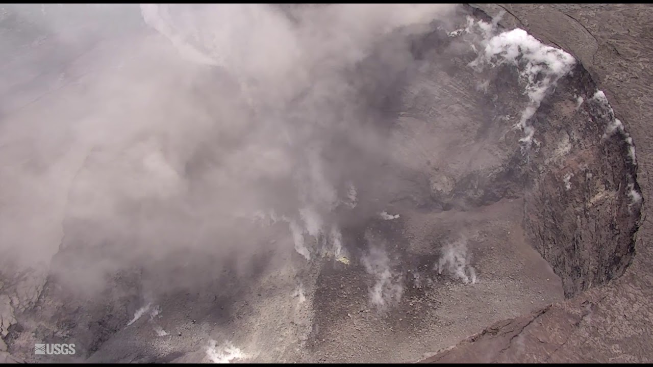
As fissure 8 lava flowed into Green Lake, the lake water boiled away, sending a white plume high into the sky.

U.S. GEOLOGICAL SURVEY
Fissure 8 lava fountain feeds a massive channelized lava flow moving to the northeast.

U.S. GEOLOGICAL SURVEY
Fissure 8 lava flow looking east today.

U.S. GEOLOGICAL SURVEY
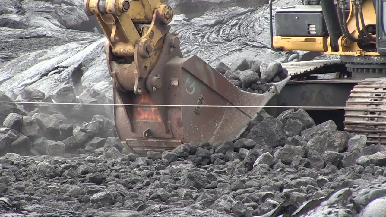
An HVO geologist documents the fissure 8 flow southeast of Four Corners (the intersection of Highways 132 and 137).

U.S. GEOLOGICAL SURVEY
East side of the fissure 8 flow on the “lighthouse road” (east of the Four Corners intersection). The flow was about 16 feet thick when this photo was taken around 2 p.m. today.

U.S. GEOLOGICAL SURVEY
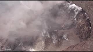
USGS scientists on HVO’s overflight this morning surveyed the fissure 8 flow front as it advanced west along Highway 132.


UPDATE: 9:45 a.m.
The Hawaii County Fire Department has rescued three people via helicopter in isolated areas this morning as the eruption activity had cut off access to Kapoho and Vacationland.
Firefighters rescued two men and one woman, according to the Maj. Jeff Hickman of the Hawaii Army National Guard.
No injuries were reported.
Hickman said, “The mission was completed around 7:15 a.m. this morning.”
First responders are conducting search and rescue missions to those in isolated areas today. Hawaii County Civil Defense is asking the public to call 935-0031 if they know of someone remaining in the evacuation area.
The Hawaii County Civil Defense has reported fissure 8 is feeding a large channelized flow that is traveling along Highway 132, the Pahoa-Kapoho Road.
The lava flow that crossed Highway 137 and Government Beach Road continues to move downslope through Kapoho Beach Lots. The flow was about 500 yards from the ocean this morning.
>> Hawaii risks include slow-moving natural, man-made disasters
>> #PunaStrong puts on its own show amid lava disaster
>> 7 cited for loitering in lava disaster zone in Lower Puna
>> Lava flows reignite debate over the safety and future of the Puna Geothermal Venture facility
>> Evacuation order came suddenly for Kapoho residents
>> Lava crosses Highway 137, limits access to Kapoho, Vacationland
>> Leilani Estates evacuee dies by apparent suicide
>> Big Isle mayor envisions ‘whole new community’ for Puna
>> Hawaii island resident smashes pickup into hardened lava
RELATED PHOTOS AND VIDEOS
>> Live webcams from Hawaii island
>> USGS Kilauea update on June 2, 2018
>> Maku‘u Farmer’s Market benefit concert to benefit lava victims, June 2
>> Emergency lava route through Chain of Craters-Kalapana Road nearly complete, June 1
>> Changes occurring within Halemaumau crater, June 1
>> Pyroclasts inundate Leilani Estates as lava continues to flow, May 31
>> Hawaii Army National Guard Major Jeff Hickman provides an update, May 31
>> Leilani Estates residents talk about evacuating as lava advances, May 31
>> Hawaii Fire Department tracks lava from the air, May 30
>> Aerial view of lava flow in Leilani Estates, May 29
>> No break over holiday weekend for Kilauea, May 28
COMPLETE KILAUEA COVERAGE
>> Star-Advertiser volcano coverage
>> Kilauea Volcano YouTube playlist
6 a.m.
Activity continues at fissure 8 as it feeds a large flow moving along Highway 132.
The flow that crossed Highway 137 and Government Beach Road on Saturday has since reached Kapoho Kai Road to the south and as far east at Iliani Road.
Civil Defense is asking the public to call 935-0031 if they know of someone remaining in the evacuation area.
Residents downwind of the Kilauea summit should take action to limit exposure to gas and ash. Residents along the coast should be aware of laze from lava entering the ocean.
Saturday, 8 p.m.
The fissure 8 flow continues to advance into Kapoho Crater and through Kapoho Beach Lots.
Lava entered Green Lake within Kapoho Crater at 10 a.m., producing a large steam plume. By 3 p.m., the lava had filled the lake and evaporated all the water, the Hawaii County Fire Department reported.
6 p.m.
The Hawaii County Civil Defense Agency says lava eruptions are continuing in Leilani Estates and Lanipuna Gardens.
Fissure 8 is feeding a large channelized flow traveling along Highway 132, the Pahoa-Kapoho Road.
Lava has crossed Government Beach Road and Highway 137, and inundated the Four Corners intersection. The flow is moving downslope toward the ocean into Kapoho Beach Lots.
Due to lava crossing Highway 137, there is no access to Kapoho, Vacationland, Highway 132, and Highway 137.
However, Government Beach Road, between Kahakai Boulevard and Cinder Road, is open to Waa Waa and Papaya Farms Road residents only with official credentials. There is no curfew.
Kilauea lower East Rift Zone lava flows and fissures, June 2 by Honolulu Star-Advertiser on Scribd
Given the dynamic nature of Kilauea’s lower East Rift Zone eruption, with changing vent locations, fissures starting and stopping, and varying rates of lava effusion, map details shown here are accurate as of the date/time noted. Shaded purple areas indicate lava flows erupted in 1840, 1955, 1960, and 2014-2015. (see large map)
1 p.m.
The lava flow from fissure 8 continues to move along Highway 132 with two flow fronts.
The northern front is above the Four Corners intersection of Highway 132 and 137. The southern front crossed Highway 137 earlier today, about 300 feet south of Four Corners. Part of the flow hit Green Lake and is creating a steam plume in the area. The flow is moving downslope toward the ocean.
Noon
Another explosion occurred at the Kilauea Summit, causing a plume that reached a height of about 10,000 feet, according to the U.S. Geological Survey.
The explosion occurred at about 1:40 p.m. Friday, according to geophysicist Kyle Anderson.
Despite the collapse of the vent, Anderson said, “It is possible for explosions to occur through the rubble at the bottom of the vent.”
Volcanic gas emissions at the summit remain high.
9:45 a.m.
The large lava flow front crossed Highway 137, south of the Four Corners area, this morning, according to the Hawaii County Civil Defense.
With the lava crossing Highway 137, there is currently no access to Kapoho, Vacationland, Highway 132 and Highway 137. The intersection of Highway 137 and Highway 132 is locally known as Four Corners.
Government Beach Road, between Kahakai Boulevard and Cinder Road, remains open to Waa Waa and Papaya Farms Road residents only with official credentials. There is no curfew in effect.
8:40 a.m.
HILO >> Emergency responders conducted evacuation efforts Friday night through the early morning hours today as the active lava flow heads northeast toward the intersection of Highway 137 and Highway 132, locally known as Four Corners, according to the Hawaii County Civil Defense.
“It has not reached but it’s getting very close,” said spokeswoman Janet Snyder today.
According to geophysicist Jim Kauahikaua of the U.S. Geological Survey, the flow front has split into two lobes with the the northern branch about a 100 yards from Government Beach Road and a southern branch about 500 yards from Green Lake.
Snyder said, “There is a possibility that one of the lobes or branches will reach (Kapoho) Beach Lots.”
There are currently 351 people sheltered at the Pahoa Community Shelter and 53 people at the Keaau Armory located near Herbert Shipman Park.
6:30 a.m.
The flow front from fissure 8 has reached Highway 132 and is about 150 yards from the Four Corners area. It’s possible the front could cross Government Beach Road near Four Corners within hours.
Fissure 8 remains active and is producing a large flow.
Government Beach Road, between Kuna Street and Four Corners, is open to residents only with official credentials. There is no curfew.
FRIDAY, 10 p.m.
Fountaining at Fissure 8 is reaching 180 to 220 feet high and continues to feed a channelized lava flow to the northeast along Highway 132 and down into the Four Corners area. The intersection of Highway 137 and Highway 132 is locally known as Four Corners.
The U.S. Geological Survey reports small overflows from the channel are occurring along its length, including in a few places near the intersection of Highway 132 and Pohoiki Road.
As of 9:50 p.m., the flow front was approximately 0.28 miles from the intersection.
Pele’s hair and other lightweight volcanic glass from Fissure 8 are falling downwind of the fissure and gathering in Leilani Estates.
6:45 p.m.
The active lava flow front has reached Highway 132 and is a 1/2 mile from the “Four Corners” area. The intersection of Highway 137 and Highway 132 is locally known as Four Corners.
The flow from fissure 8 may cross Government Beach Road near Four Corners within hours, said the Hawaii Civil Defense.
Government Beach Road, between Kuna Street and Four Corners, is open to residents only with official credentials. There is no curfew.
Also, the Pahoa post office is open during normal business hours and has temporary Sunday hours from 10 a.m. to 2 p.m. for mail and package distribution only.
High Bacteria Count at Puako Middle of Lot
The state Health Department has posted a high bacteria advisory for waters off Puako Middle of Lot on the Big Island.
Levels of 384 per 100 milliliters of enterococci were detected during routine beach monitoring.
The advisory is posted because testing for enterococci indicate that potentially harmful microorganisms such as bacteria, viruses, protozoa, or parasites may be present in the water. Swimming at beaches with pollution in the water may make you ill.
Potentially harmful microorganisms such as bacteria, viruses, protozoa, or parasites may be present in the water, according to the state Health Department, and swimming at beaches with pollution in the water may make one ill.
Children, the elderly, and people with weakened immune systems are the most likely populations to develop illnesses or infections after coming into contact with polluted water, usually while swimming.
While swimming-related illnesses can be unpleasant, they are usually not very serious, require little or no treatment or get better quickly upon treatment, and have no long-term health effects.
Signs have been posted, and the advisory will remain in effect until water sample results no longer exceed the threshold level of 130 enterococci per 100 milliliters.
Updates are available at this link.
2:25 p.m.
HILO >> A great majority of the steam and ash plume from the lava lake at the Kilauea summmit is gone, marking an important change in the eruption activity, a U.S Geological Survey geophysicist said at a briefing today.
Kyle Anderson of USGS said it’s too soon to ascertain what that change means. “I think it’s still too soon to determine its significance.”
“It’s possible that new explosions will blast through the rubble at the bottom of the vent. These may or may not be larger than previous explosions,” Anderson said. “It’s also possible that the vent could become permanently blocked, ending explosions entirely.”
As the lava lake began to recede on May 2, the USGS had warned of possible violent eruptions should the magma at the summit drain below the water table, causing blockage to the conduit and steam pressure buildup.
A lava flow, meanwhile, to the northeast along Highway 132 was reportedly advancing at a rate of about 100 yards per hour within the last few hours as of 11 a.m. today, according to geologist Janet Babb of the USGS.
Babb cautioned the rate of advance changes frequently.
1:45 p.m.
No tsunami is expected from a 4.4 magnitude earthquake reported in the summit region of Kilauea this afternoon.
The Pacific Tsunami Warning Center reported the earthquake at 1:37 p.m. and some areas may have experienced shaking.
Noon
The lava flow from fissure 8 in Leilani Estates was moving at a rate of about 100 yards per hour this morning, and if it continues at that rate, it will reach “Four Corners” by mid-afternoon today, according to a county official. The Hawaiian Volcano Observatory said fissure 8 is very active and producing a large flow.
The intersection of Highway 137 and Highway 132 is locally known as “Four Corners.” If it crosses Highway 137 as it appears to be poised to do, it will isolate more than 500 homes in the Kapoho area.
Residents in Vacationland, Kapoho Beach Lots and areas near Highway 137 have been advised to evacuate or risk isolation.
Shelters at Keaau Community Center and the Sure Foundation Church have been relocated to the Keaau Armory, located in the back of Herbert Shipman Park off of Highway 11. The shelter at Pahoa Community Center remains open, and all shelters are pet friendly.
The Pahoa post office is open until 2 p.m. today to distribute mail and packages to evacuees and residents experiencing delays in mail delivery.
11:30 a.m.
HILO >> Hawaii island Mayor Harry Kim plans to help refugees from the May 3 Kilauea eruption by launching a rapid re-housing initiative comparable to the resettlement effort that rolled out after a tsunami devastated portions of Hilo in 1960.
Kim told listeners in a briefing at the Hawaii County Civil Defense headquarters this morning that the authorities in 1960 developed a strategy called the Kaikoo Plan, which was completed within six months, said Kim’s spokeswoman Janet Snyder.
Map of Mandatory Evacuation Order by Honolulu Star-Advertiser on Scribd
That plan resulted in new housing in Waiakea outside the tsunami inundation area for people who had been displaced, the development of the Kaikoo Mall in urban Hilo, and the creation of what is now known as the Kanoelehua Industrial area in Waiakea.
“Harry says he’s going to make a whole new community for the people of Puna, to give them hope that there’s a better tomorrow,” Snyder said. “He says, ‘If they could create a plan in six months, so can we.’”
The May 23, 1960 tsunami was triggered by a huge earthquake in Chile and killed 61 people. It demolished much of downtown Hilo and wiped out a neighborhood known as Shinmachi town. Shinmachi, which stood on what is now open space in Wailoa State Park, was never rebuilt.
Snyder said she did not have any immediate information on specific plans for additional housing for evacuees.
The county is continuing the evacuation today of the Kapoho area — including the Vacationland subdivision and homes along Highway 137 — as lava from a fissure in Leilani Estates continued its advance to within about a mile of the last evacuation route out of the area.
The lava is approaching the intersection of Highway 137 and Highway 132, a spot that is locally known as “Four Corners.” If it crosses Highway 137 as it appears to be poised to do, it will isolate more than 500 homes in the Kapoho area.
The lava flow from fissure 8 in Leilani was moving at a rate of about 100 yards per hour this morning, and if it continues at that rate, it will reach Four Corners by mid-afternoon today, according to a county official.
The lava has already forced the evacuation of much of the Leilani Estates subdivision and all of Lanipuna Gardens subdivision, which between them had more than 800 homes.
So far, lava from the Leilani eruption has destroyed 87 homes, county officials reported today.
Star-Advertiser reporters Rosemarie Bernardo, Kevin Dayton and Andrew Gomes on Hawaii island contributed to this report.


