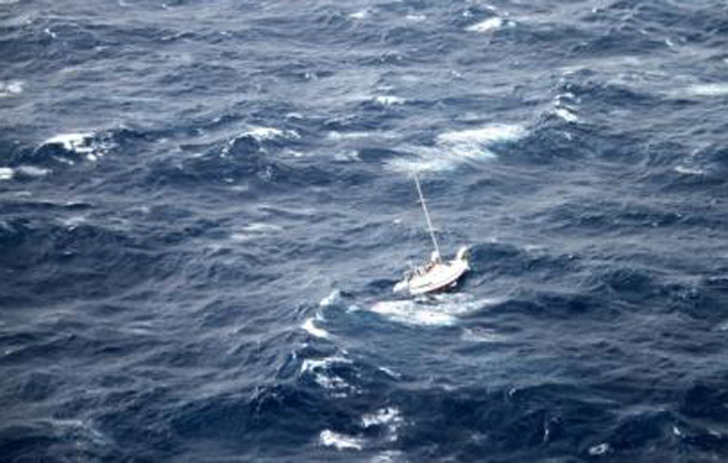
Julio smites sailboat northeast of islands


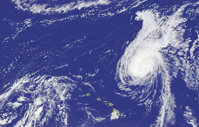
The GOES-15 geostationary satellite shot this photo of Hurricane Julio on Sunday. The Hawaiian Islands can be seen southwest of the storm.


Hurricane Julio may be fast departing the Hawaiian Islands, but it posed an extreme hazard Sunday for a drifting sailboat with three people aboard some 400 miles northeast of Oahu.
The Coast Guard said Sunday that the 42-foot vessel Walkabout, sailing from Stockton, Calif., was disabled and taking on water in 30-foot seas.
The crew initially faced hurricane winds of 92-115 mph, but the winds dropped to about 45 mph, the Coast Guard said.
The vessel’s lifeboat and a hatch cover were blown away, and the crew was using a bilge pump to remove water entering one of the hatches, the Coast Guard said.
The crew was unable to retrieve a replacement life raft and pump dropped by an HC-130 Hercules airplane crew from Barbers Point on Sunday afternoon, the Coast Guard said, and another airplane crew was sent to try another drop.
The second airplane arrived at 7 p.m. Sunday and was expected to remain with the distressed vessel until the 661-foot container ship arrived to assist in the rescue.
Don't miss out on what's happening!
Stay in touch with breaking news, as it happens, conveniently in your email inbox. It's FREE!
Manukai was diverted to assist in the rescue and was expected to arrive on the scene sometime Sunday night, the Coast Guard said.
At 7:15 a.m. Sunday officials with the Joint Rescue Coordination Center in Honolulu received notification from the International Emergency Response Coordination Center in Texas that an alert message was received from Walkabout requesting Coast Guard assistance.
The rescue center diverted a National Hurricane Center plane, Teal 76, from inside Hurricane Julio to locate the vessel and establish VHF radio communications.
At 10:49 a.m. Teal 76 reported mayday calls being broadcast from Walkabout.
The first HC-130 Hercules airplane crew left Barbers Point at 11:10 a.m. to deliver a life raft and relieve Teal 76.
In the Hawaiian Islands the effects of Julio were still being felt Sunday.
A high-surf advisory remains in effect for the east shores of all islands until 6 p.m. Monday thanks to a large east swell generated by the hurricane.
Surf heights of 8 to 12 feet Sunday were expected to drop to 6 to 8 feet Monday on Kauai, Oahu, Maui and Hawaii island.
The National Weather Service said the state should be drying out as Julio moves on a northerly track away from the isles.
Forecaster Derek Wroe said the storm’s presence northeast of the islands could disrupt typical tradewind patterns and produce lighter wind and muggy conditions over the next couple of days. The light wind will allow onshore sea breezes to develop, with interior and leeward clouds and showers forming during the afternoons.
The hurricane is expected to weaken to a tropical storm by Tuesday.
Trades will return during the second half of the week, the National Weather Service said.
On Friday, Hawaii island took the brunt of Tropical Storm Iselle, with 75 mph winds tearing off roofs, uprooting trees and toppling utility lines. Julio followed Iselle but passed to the north of the islands.


