Flash flood watch continues for all islands as storm generates waterspouts and hail
COURTESY ALLAN ROZENBERG
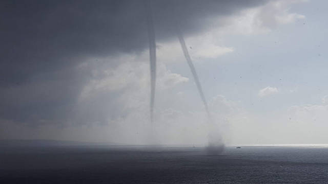
Two waterspouts appeared this afternoon off Papawai Scenic Lookout near Maui’s South Shore.
NATIONAL WEATHER SERVICE
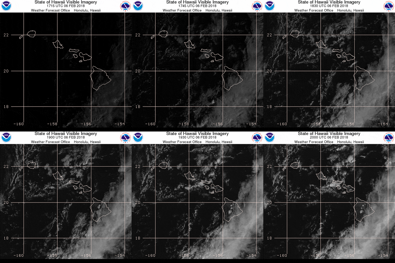
A series of satellite images through 10 a.m. show an unstable atmosphere over the islands this morning.
ED LYNCH / ELYNCH@STARADVERTISER.COM
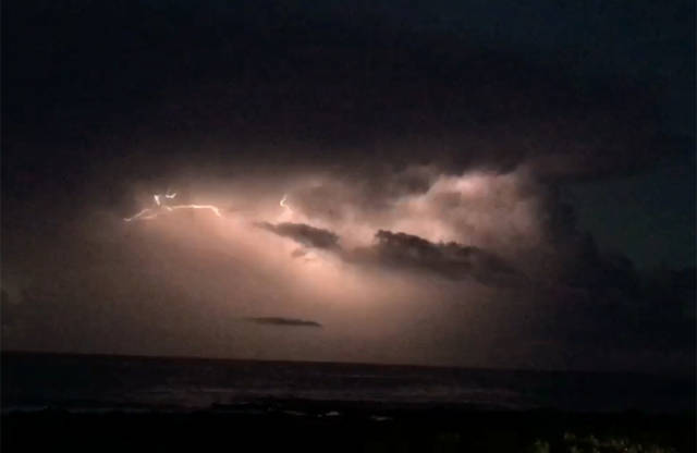
Lightning lit up the clouds off Sandy Beach early this morning.
NATIONAL WEATHER SERVICE
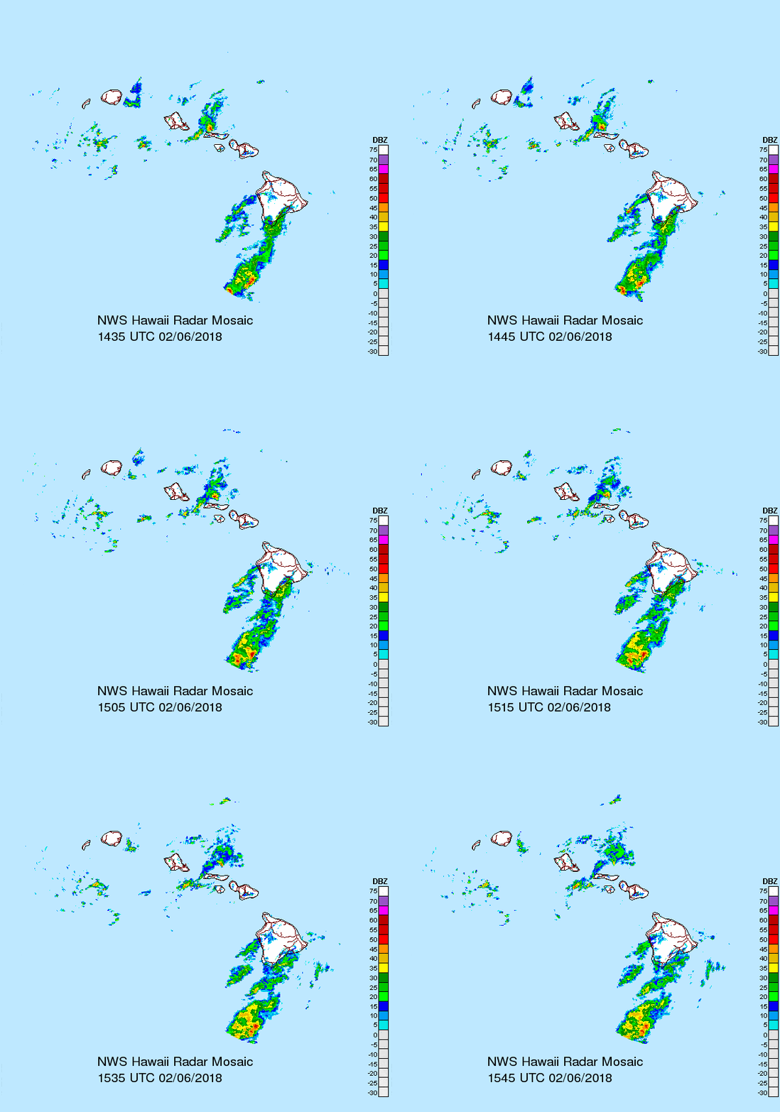
A series of radar images through 5:45 a.m. shows areas of moisture moving across the islands.
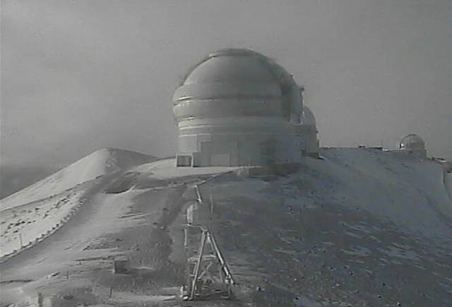
CANADA-FRANCE-HAWAII TELESCOPE
The view to the north this morning atop Mauna Kea.


UPDATE 7:45 p.m.
A flash flood watch continues for all islands through Wednesday afternoon.
The National Weather Service said there is a chance of extreme rainfall that could cause flash flooding.
Conditions are favorable for the development of slow-moving heavy showers and rain may also affect urban areas and lower elevations prone to flooding, the weather service said.
UPDATE 4:45 p.m.
Maui and parts of Oahu are under a flood advisory this evening and the entire state remains under a flash flood watch until Wednesday afternoon as an unsettled weather system delivers heavy rain, thunderstorms, hail and waterspouts.
Don't miss out on what's happening!
Stay in touch with breaking news, as it happens, conveniently in your email inbox. It's FREE!
The National Weather Service said members of the public have reported seeing two waterspouts west of Kihei at about 3:05 p.m, a waterspout south of Ewa Beach at about 2:33 p.m., and pea-sized hail near Keokea, Maui, at about 1:50 p.m.
Forecasters placed the island of Maui and much of Oahu under a flood advisory until 7 p.m. and 7:30 p.m., respectively.
The Oahu advisory covers Ahuimanu, Punaluu, Hauula, Mililani, Kaneohe, Haleiwa, Wheeler Field, Wahiawa, Waialua, Waikane, Schofield Barracks and Kaneohe Marine Base. Some of those area saw rain falling at a rate of 2 inches an hour late this afternoon, the weather service said.
(function(d, s, id) {
var js, fjs = d.getElementsByTagName(s)[0];
if (d.getElementById(id)) return;
js = d.createElement(s); js.id = id;
js.src = ‘https://connect.facebook.net/en_US/sdk.js#xfbml=1&version=v2.12&appId=290167678132462&autoLogAppEvents=1’;
fjs.parentNode.insertBefore(js, fjs);
}(document, ‘script’, ‘facebook-jssdk’));
Water spouts on the ocean..on Maui, Hawaii. First time I have ever seen one. Or as Rick says, my first water tornado;
Posted by Pam Osborne on Tuesday, February 6, 2018
On the Valley Isle, “heavy showers and thunderstorms have decreased over windward portions of Maui, while isolated heavy showers and thunderstorms have moved up from the south over leeward portions of the island,” forecasters said at 4:05 p.m.
PREVIOUS COVERAGE
The unstable weather over the islands today is expected to give way to scattered thunderstorms this afternoon that will generate strong gusty winds and hail in some areas.
“Some of these thunderstorms will be capable of producing strong and gusty winds, frequent lightning, intense downpours and hail,” the National Weather Service said in a special weather statement this morning.
A flash flood watch is also in effect for all islands today and is expected to last until Wednesday afternoon.
“A strong trough in the upper atmosphere will continue to bring a chance of very heavy rain and thunderstorms,” weather service forecasters said. “Extreme rainfall rates with these storms will bring a high potential for flash flooding.”
“When thunderstorms approach, you should move indoors.” forecasters advise. “Stay away from windows and electrical appliances until the the storm is over. Be aware that lightning can strike several miles away from a thunderstorm. It does not have to be raining where you are to be struck by lightning.”
On Oahu, rain fell at a rate of up to 2 inches per hour in some areas Monday afternoon.
The weather will dry out by week’s end, but more wet weather is possible next week.
With heavy snow already falling, the summits of Mauna Kea and Mauna Loa on Hawaii island are under a winter storm warning this morning. “Additional snow accumulations of 5 to 8 inches are expected,” weather officials said.
The state Department of Health issued brown water advisories for Waimea Bay and the island of Maui due to heavy rains. The public is advised to stay out if the water because of possible pathogens.


