Another cold front on the way, bringing chilly nights and ‘winter spell’ for Hawaii summits

COUIRTESY NATIONAL PARK SERVICE/ ZANE KESECKER
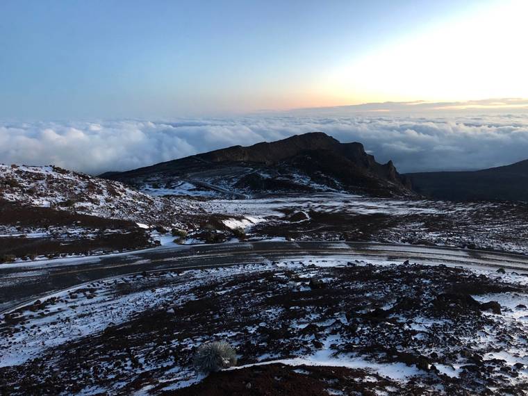
Haleakala Crater following winter weather on Feb. 4.
UPDATE 5 p.m.
A high surf advisory has been issued for the north and west shores of all isles from Niihau to Molokai, and north shores of Maui, starting at noon Tuesday through 6 a.m. Wednesday.
The National Weather Service warns of surf of 12 to 16 feet for north shores, and of 8 to 12 feet for west shores due to a new, northwest swell.
Impacts should be moderate, but strong, breaking waves and rip currents will make swimming difficult and dangerous.
A fast-moving cold front has already arrived on Kauai this afternoon, and is on its way down the isle chain, arriving on Oahu shortly, then Maui and Hawaii island overnight, bringing “a relatively short period of widespread clouds and showers,” along with a chance of thunderstorms.
Gusts of up to 30 mph are expected as the front passes through.
Don't miss out on what's happening!
Stay in touch with breaking news, as it happens, conveniently in your email inbox. It's FREE!
Officials have also issued a winter weather advisory for the summits of Haleakala, Mauna Kea and Mauna Loa shortly after 3 p.m., which is in effect overnight into Tuesday.
In addition to freezing rain, another inch of snow is expected at Haleakala, and up to 3 inches for Big Isle summits, along with winds gusting up to 35 mph.
Travel to the summits should be avoided due to patchy areas of black ice.
A special marine remaining also remains in effect for Kauai Channel and leeward and windward Oahu waters, through 5:45 p.m. today.
At 4:10 p.m., a line of strong thunderstorms associated with the cold front was in the Kauai Channel, moving southeast at 25 knots, and capable of producing waterspouts.
A small craft advisory for all Hawaii waters has been issued from 6 p.m. today to 6 p.m. Tuesday.
PREVIOUS COVERAGE
Another cold front northwest of Hawaii is on the way, and expected to move through Kauai this afternoon, forecasters said, bringing scattered showers and a slight chance of thunderstorms as it sweeps from west to east down the island chain.
The National Weather Service expects the leading edge of the front to reach Kauai this afternoon, then Oahu this evening and Maui County tonight, and Hawaii island on Tuesday.
This cold front is forecast to bring a period of potential brief downpours as it moves through, according to meteorologist Gavin Shigesato, but will probably not be as disruptive as the one last week, which prompted flood warnings. The latest cold front also does not have strong winds and gusts moving in ahead of it.
Today’s forecast includes increasingly cloudy skies for Kauai, along with scattered showers and a slight chance of thunderstorms in the afternoon.
Oahu and Maui are also expected to be partly cloudy, with isolated showers, and highs from 75 to 80 degrees.
Overnight lows dip once again into chilly temperatures — from 60 to 65 degrees for most places, but into the 50s for Kahului Airport on Maui, and Lihue, Kauai.
Light and variable winds are expected today before shifting to the north after midnight tonight, and picking up on Tuesday.
Forecasters have not yet issued a winter weather advisory, but warn that this front may bring a “short-lived spell of winter weather” across Haleakala and Big Isle summits.
Surf, meanwhile, remains stable today as current swells subside, but a large, northwest swell is expected to build late tonight and peak Tuesday, likely prompting another advisory.
Surf of 5 to 7 feet at north shores today is expected to build to 12 to 16 feet Tuesday, while surf of 2 to 4 feet at west shores builds go 9 to 12 feet Tuesday.
Surf for south and east shores remains stale, at 1 to 3 feet and 2 to 4 feet, respectively, today and Tuesday.
Dry, north winds are expected to build in behind the front, bringing cool, breezy weather — and a crisp feel to the air as dew points drop into the 50s again. Expect cooler than normal temperatures in the early morning hours.


