Small earthquake centered off Hawaii island
USGS / HAWAIIAN VOLCANO OBSERVATORY
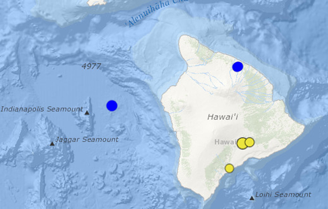
The dots in blue show the location of two earthquakes greater than magnitude 3.0 in Hawaii over the last two days. The dots in yellow show earthquakes with a magnitude 3.0 or higher over the last two weeks.
The dots in blue show the location of two earthquakes greater than magnitude 3.0 in Hawaii over the last two days. The dots in yellow show earthquakes with a magnitude 3.0 or higher over the last two weeks.
A magnitude 3.9 earthquake struck off the coast of the Big Island early Tuesday morning.
The epicenter was about 32 miles west-northwest of Kailua-Kona at a depth of about 7.7 miles at about 3:17 a.m.
No tsunami alerts were issued and only a few responses from Hilo and Kailua-Kona were posted on the U.S. Geological Survey’s “Did You Feel It?” website.
On Monday, another minor earthquake with an estimated 3.2 magnitude struck at about 12:49 p.m., about 2.2 miles south-southwest of Paauilo on the Hamakua Coast at a depth of about 5.5 miles.
That earqhuake was felt along the Hamakua Coast, according to the U.S. Geological Survey’s “Did You Feel It?” website.


