Leilani Estates lava might not be part of the eruption that began in 1983, scientists say


DENNIS ODA / DODA@STARADVERTISER.COM
A National Guardsman took readings of noxious gas Thursday near the lava flow over Highway 132.

DENNIS ODA / DODA@STARADVERTISER.COM
Media took pictures and video Thursday of slow-moving lava from fissure 8, about 20 feet from Pohoiki Road.

DENNIS ODA / DODA@STARADVERTISER.COM
National Guardsmen took readings of noxious gas on Kupono Street near the eruption from fissure 8 in Leilani Estates. They were standing on what looks to be a dirt road but is actually a paved road covered with ash and pyroclastic rocks that fell from a fissure 8 eruption.
HILO >> U.S. Geological Survey scientists are debating whether the devastating, ongoing Leilani Estates eruption should be declared a “new” eruption that is distinct from the Puu Oo eruption on the flank of Kilauea Volcano, which began in 1983.
The Leilani Estates event that began May 3 appears to have effectively diverted magma from Puu Oo, and perhaps has ended that chapter of the long history of Kilauea Volcano.
“We have been talking about that, and we’re pretty much ready to call this a new eruption,” said Wendy Stovall, a U.S. Geological Survey volcanologist. “Puu Oo doesn’t show any sign of activity at all.”
>> Allegedly intoxicated man arrested after crashing into hardened lava
>> Arrests possible for Leilani Estates holdouts
>> Leilani Estates lava might not be part of the eruption that began in 1983
>> Kau residents irritated by ashfall from volcano
>> California man cited for flying drone in eruption no-fly zone
>> Pahoa man, 61, charged with armed robbery after shots fired in Leilani Estates video
>> Lava scientists’ drone guides lost resident through jungle
>> Puna man ‘just wanted to live’ after nearly losing leg to lava bomb
RELATED PHOTOS AND VIDEOS
>> Live webcams from Hawaii island
>> Pyroclasts inundate Leilani Estates as lava continues to flow, May 31
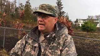
>> Hawaii Army National Guard Major Jeff Hickman provides an update, May 31
>> Leilani Estates residents talk about evacuating as lava advances, May 31
>> Hawaii Fire Department tracks lava from the air, May 30
>> Aerial view of lava flow in Leilani Estates, May 29
>> No break over holiday weekend for Kilauea, May 28
COMPLETE KILAUEA COVERAGE
>> Star-Advertiser volcano coverage
>> Kilauea Volcano YouTube playlist
Don't miss out on what's happening!
Stay in touch with top news, as it happens, conveniently in your email inbox. It's FREE!
According to USGS, the Puu Oo eruption ranks as the longest and most voluminous known outpouring of lava from Kilauea Volcano’s East Rift Zone in more than 500 years, and over the decades it wiped out most or all of the communities of Kapaahu, Royal Gardens and Kalapana.
County officials said the Leilani Estates eruption has now destroyed 77 homes, and on Thursday it had reached to within 1.9 miles of the coastal Highway 137, which is the last evacuation route out of the Kapoho area.
Large amounts of lava emerging from fissure 8 in the Leilani Estates subdivision have formed a pond in an elevated portion of the flow within the subdivision, raising the possibility that a breach of the pond’s walls could cause a sudden rush of lava into the surrounding area, according to Jim Kauahikaua, geophysicist with the U.S. Geological Survey.
Lava from that same fissure has been erupting in fountains that are 260 feet high, and one flow from that fissure now extends downslope for about 4.5 miles, which is the farthest a flow has reached since the Leilani Estates event began, Kauahikaua said. That flow was advancing toward the coast and Highway 137 at a rate of about 90 yards per hour, he said.
Hawaii island Mayor Harry Kim announced Thursday that all residents are required to evacuate from the portion of Leilani Estates that is closest to the most active vents, which includes Pomaikai Street and all portions of the subdivision to the east of it. County officials warned that anyone who refuses to evacuate could be arrested.
The debate over whether the lava pouring into Leilani Estates is a separate eruption from Puu Oo is unsettled.
The Puu Oo eruption began Jan. 3, 1983, when fissures opened on Kilauea’s East Rift Zone, and in the months that followed the eruption became focused at a single vent. During the next three years, a series of lava fountains built a cone of cinder and lava spatter that was dubbed Puu Oo.
Lava from the Puu Oo eruption plowed through Kapaahu and first reached the ocean Nov. 28, 1986, after covering a portion of Highway 130. That highway, which becomes Chain of Craters Road with Hawai‘i Volcanoes National Park, is now being reopened as an evacuation route to help cope with the May 3 Leilani Estates eruption.
The most destructive period of the Puu Oo eruption was in the spring of 1990, when it entered Kalapana and buried Kalapana Mauna Kea Congregational Church, a store and more than 100 homes in and around the Kalapana Gardens subdivision.
There is still a bit of deflation happening at Puu Oo — a sign that magma may be draining out of the area of the puu — “but it just doesn’t seem like magma will return to that area,” Stovall told reporters Thursday.
“I can’t really call it official because I’m not the scientist-in-charge, but we’ve been discussing that, about what does this mean, is it a new eruption and are we going to have to call it something new,” she said.
Kauahikaua said he has been too busy tracking surface lava flows to closely follow that debate, but noted that the chemical composition of the lava emerging from Leilani Estates is nearly identical to lava generated from Puu Oo.
When considering the distinction between one eruption and another, “in a way it becomes semantic,” he said.
The number of people seeking emergency shelter after escaping from lava flows in Lower Puna hit a new high of 409 Thursday in the wake of evacuations of two additional subdivisions earlier this week, county officials said.
The county reported 351 people were being sheltered Thursday morning at the Pahoa Community Center, and another 49 were being housed at the Keaau Community Center. Nine more evacuees were being sheltered at a facility operated by Sure Foundation Church in Keaau.
Snyder said Kim noted during a Civil Defense briefing this morning that “we have a tremendous housing problem on our hands.”
Authorities launched an emergency evacuation of Kapoho Beach Lots and the Vacationland subdivision in the Kapoho area early Wednesday morning, and the county is urging residents of the sparsely populated Waawaa area along the Lower Puna coastline to evacuate as well.
Construction began Wednesday morning in an effort to reopen Chain of Craters Road to Hawai‘i Volcanoes National Park, and crews cleared about 1,600 feet of the cooled lava that had been blocking the road near the Kalapana coastline, according to national park spokeswoman Jessica Ferracane.
Ferracane said that is about half of the stretch of roadway that needs to be cleared of lava.
There are two bulldozers on the job site, and the state predicts the debris will be cleared off the road by Saturday. The road will be used as an emergency evacuation route for subdivision residents in the area if lava severs Highway 130 between Pahoa and Kalapana.
Map of Mandatory Evacuation Order by Honolulu Star-Advertiser on Scribd
Kilauea Lower East Rift Zone Fissures and Flows, May 31 by Honolulu Star-Advertiser on Scribd


