Recently formed lake in Halemaumau Crater the largest in at least 200 years

| Courtesy USGS Reconnaissance video taken prior to the October 26 water sampling mission.

2/3
Swipe or click to see more
COURTESY U.S. GEOLOGICAL SURVEY Measured from a vertical distance of about 1978 feet — from water surface to the top of the tripod on the crater rim—the dimensions of the crater lake in Halemaumau were around 233 to 236 feet north-south and 515 to 518 feet east-west on Nov. 28. The ongoing rise in water level is noticeable when the two photos, taken three days apart, are compared. 
3/3
Swipe or click to see more
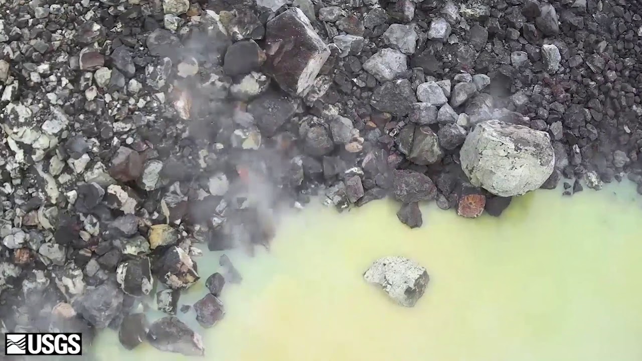
COURTESY U.S. GEOLOGICAL SURVEY The water at the bottom of Halemaumau continues to slowly rise in a photo taken on Nov. 21. 
HILO >> The greenish-blue, 520-foot long lake that recently formed at the bottom of Halemaumau Crater on Kilauea volcano amounts to the largest body of water inside the crater for at least the past 200 years, and U.S. Geological Survey scientists are keeping a wary eye on both the lake and what is happening below it. USGS Geologist Matthew Patrick told members of the Hawaii County Council Tuesday the lake is still being fed by the underground water table, and is rising steadily at a rate of five to six inches per day. It is now about 60 feet deep, and in theory could rise another 150 to 180 feet before the water at the bottom of the crater would reach a state of equilibrium with the surrounding underground water table, Patrick said. Hawaii County Civil Defense officials and USGS are keeping close tabs on the steaming lake because magma and water can be an explosive mix at Kilauea. The most recent “notable” large-scale explosion at Kilauea was in 1790, and there may have been other explosive activity in the summit area in the early 1800’s that wasn’t well documented, Patrick said. But major explosive episodes did happen at the summit from about 1500 to the early 1800’s, he said, and a relatively small explosion was recorded at the summit in 1924. Don't miss out on what's happening!Stay in touch with top news, as it happens, conveniently in your email inbox. It's FREE!
By clicking to sign up, you agree to Star-Advertiser's and Google's Terms of Service and Privacy Policy. This form is protected by reCAPTCHA.
“It’s thought that some of that was associated with ground water, or even water on the surface,” Patrick said. The exact mechanics that drove that explosive activity is not well understood, he said, but rapidly rising magma may have suddenly penetrated into underground or surface water and helped or caused the explosions. Explosive activity centuries ago at Halemaumau sometimes tossed rocks and debris as far away as what is now Volcano Village. On the other hand, there is plenty of shallow underground water at the summit, and many eruptions took place over the last century without causing explosions, Patrick said. “Work by USGS geologists has shown that Kilauea summit kind of goes through these phases. It will go through an explosive phase that will last for centuries, and fortunately the last 200 years it has been a dominantly non-explosive phase — so, (there are) lava lakes and lava flows at the summit,” he said. Magma drained from the summit during the 2018 East Rift Zone eruption that destroyed Kapoho and much of Leilani Estates, but magma has been steadily recharging the underground magma chamber since then, Patrick told the council. So far, the magma “remains deep within the system,” he said. He reminded council members that Kilauea’s summit has once of the best monitoring networks of any volcano in the world, with scientists gathering data from web cameras and thermal cameras, monitoring gas emissions associated with magma, and tracking activity with instruments to measure earthquakes and the movement of the earth’s surface as below-ground magma intrudes into an area. Scientists were able to predict numerous eruptions in the 1960s and 1970s because there was “inflation” of the ground as magma flowed below the surface into an area. But the eruption that formed the lava lake at Kilauea in 2008 “was the one event that was not preceded by inflation in the past 50 to 60 years,” he said. “At volcanic lakes, there is always a small chance that small gas-driven driven explosions can occur without much warning, but presumably these would be small and their impact would limited to the caldera region, inside the caldera,” he said.
0 Comments
By participating in online discussions you acknowledge that you have agreed to the Terms of Service. An insightful discussion of ideas and viewpoints is encouraged, but comments must be civil and in good taste, with no personal attacks. If your comments are inappropriate, you may be banned from posting. Report comments if you believe they do not follow our guidelines.
Having trouble with comments? Learn more here.
Please log in to comment
Subscriber FavoritesNancy Pelosi injured in Europe, hospitalized for treatmentHonolulu City Council approves seizure of Queen TheaterTrump policies create uncertainty for Hawaii economyKennedy lawyer calls for FDA to revoke polio vaccine approvalTrump calls for end to daylight saving timeMore Editors' PicksHonolulu City Council approves seizure of Queen TheaterTrump policies create uncertainty for Hawaii economyMaui man is sentenced to 12 years for selling fatal fentanyl dose
Rearview Mirror: Kimchi and Spam musubi among year’s tasty topicsKokua Line: Is UH warning foreign students about returning to U.S.?
|


