Fissure 8 lava flow moving north; laze creating plume at Kapoho Bay


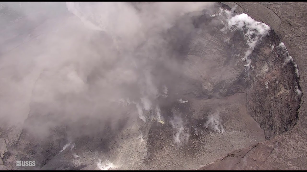

CIVIL AIR PATROL VIA U.S. GEOLOGICAL SURVEY
Lava advanced toward the ocean in the Kapoho area of Hawaii island Sunday afternoon.

U.S. GEOLOGICAL SURVEY
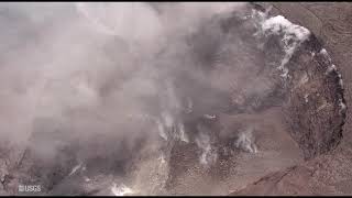
The lava flow from fissure 8 was seen pouring into entering Kapoho Bay during an overflight at 6:13 a.m. today. The ocean entry was reported to have occurred by 10:30 p.m. Sunday.

U.S. GEOLOGICAL SURVEY VIA AP
Fissure 8 lava flows near Pahoa on Saturday. The lava flowed into Green Lake, causing the lake water to boil away and sending a white plume high into the sky visible from afar.

U.S. GEOLOGICAL SURVEY VIA AP
Lava from fissure 8 flowed near the Four Corners intersection near Pahoa on Saturday.

UPDATE: 6 p.m.
The lava flow from fissure 8 continues to fill Kapoho Bay and is sending a large laze plume into the air along the coastline.
A community information meeting is scheduled for Tuesday at the Pahoa High School cafeteria at 5 p.m.
2:15 p.m.
The channelized flow from fissure 8 is starting to move north toward Waa Waa and Papaya Farms Road, according to the Hawaiian Volcano Observatory.
The lava flow into the ocean at Kapoho Bay is emanating a large laze plume along the coastline. Laze is formed when hot lava impacts the ocean, sending hydrochloric acid and steam with fine glass particles into the air.
Don't miss out on what's happening!
Stay in touch with top news, as it happens, conveniently in your email inbox. It's FREE!
The corrosive gas mixture causes irritation to eyes, skin and lungs.
8:30 a.m.
The total number of homes destroyed by lava has jumped to 117 from 87, according to the Hawaii County Civil Defense today.
Spokeswoman Janet Snyder said lava has destroyed an estimated 20 to 40 homes in Kapoho.
Some homes in Vacationland have been overtaken by lava, however, the exact number is unclear at this time.
Snyder indicated most of the homes in Vacationland are still standing but are threatened.
>> Number of homes destroyed by lava jumps to 117
>> 18 arrested in past week for loitering in lava zone
>> Man charged with running Puna checkpoint near approaching lava
>> Kilauea eruption kills up to half of Big Isle forest reserve
>> Lava nears more coastal houses; earthquake launches ash plume 8,000 feet
>> Hawaii risks include slow-moving natural, man-made disasters
>> #PunaStrong puts on its own show amid lava disaster
>> Lava flows reignite debate over the safety and future of the Puna Geothermal Venture facility
>> Evacuation order came suddenly for Kapoho residents
>> Big Isle mayor envisions ‘whole new community’ for Puna
>> Hawaii island resident smashes pickup into hardened lava
RELATED PHOTOS AND VIDEOS
>> Live webcams from Hawaii island
>> Weekend lava activity on Hawaii island in photos, June 4
>> Lava fissure 8 helicopter flyover, June 4
>> Emergency lava route through Chain of Craters-Kalapana Road nearly complete, June 1
>> Pyroclasts inundate Leilani Estates as lava continues to flow, May 31
>> Leilani Estates residents talk about evacuating as lava advances, May 31
>> Aerial view of lava flow in Leilani Estates, May 29
COMPLETE KILAUEA COVERAGE
>> Star-Advertiser volcano coverage
>> Kilauea Volcano YouTube playlist
6:45 a.m.
Lava entered the ocean in Kapoho Bay Sunday night, according to the Hawaii County Civil Defense this morning.
The U.S. Geological Survey-Hawaiian Volcano Observatory said fissure 8 continues to feed a large channelized flow that is traveling along Highway 132, the Pahoa-Kapoho Road.
There is no access to lower Puna, Highway 132 and Highway 137 due to lava overtaking the area.
5 a.m.
As of 2:23 a.m., the Kapoho lava flow was out of visual range of U.S. Geological Survey scientists, but seismicity indicated it had not yet entered the ocean.
A moderate earthquake resulting from a volcanic explosion and collapse around Halemaumau crater occurred at 3:50 p.m. Sunday, but did not generate a tsunami.
Ash from the explosion reached up to 8,000 feet.
SUNDAY, JUNE 3
12:30 p.m.
Lava is advancing along a half-mile-wide front toward the ocean at Kapoho Bay between Kapoho Beach Road and Kapoho Kai Drive, according to the U.S. Geological Survey.
The lava flow was about 400 yards from the ocean as of 12:30 p.m. today.
The USGS reported steam is heavily emanating from fissure 9. Pele’s Hair and other lightweight volcanic glass from the fountaining at fissure 8 are falling downwind and accumulating on the grounds of Leilani Estates.
Residents are urged to minimize exposure to volcanic particles as they can cause skin and eye irritation.
Tradewinds are also pushing vog to the south and west sides of Hawaii Island. Easterly winds forecasted for this afternoon may bring vog to communities in the Volcano area.
9:45 a.m.
The Hawaii County Fire Department has rescued three people via helicopter in isolated areas this morning as the eruption activity had cut off access to Kapoho and Vacationland.
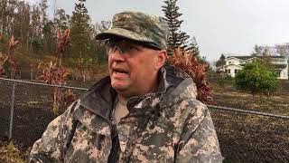
Firefighters rescued two men and one woman, according to the Maj. Jeff Hickman of the Hawaii Army National Guard.
No injuries were reported.
Hickman said, “The mission was completed around 7:15 a.m. this morning.”
First responders are conducting search and rescue missions to those in isolated areas today. Hawaii County Civil Defense is asking the public to call 935-0031 if they know of someone remaining in the evacuation area.
The Hawaii County Civil Defense has reported fissure 8 is feeding a large channelized flow that is traveling along Highway 132, the Pahoa-Kapoho Road.
The lava flow that crossed Highway 137 and Government Beach Road continues to move downslope through Kapoho Beach Lots. The flow was about 500 yards from the ocean this morning.

Given the dynamic nature of Kilauea’s lower East Rift Zone eruption, with changing vent locations, fissures starting and stopping, and varying rates of lava effusion, map details shown here are accurate as of the date/time noted. Shaded purple areas indicate lava flows erupted in 1840, 1955, 1960, and 2014-2015. (see large map)
6 a.m.
Activity continues at fissure 8 as it feeds a large flow moving along Highway 132.
The flow that crossed Highway 137 and Government Beach Road on Saturday has since reached Kapoho Kai Road to the south and as far east at Iliani Road.
Civil Defense is asking the public to call 935-0031 if they know of someone remaining in the evacuation area.
Residents downwind of the Kilauea summit should take action to limit exposure to gas and ash. Residents along the coast should be aware of laze from lava entering the ocean.
SATURDAY, JUNE 2
8 p.m.
The fissure 8 flow continues to advance into Kapoho Crater and through Kapoho Beach Lots.
Lava entered Green Lake within Kapoho Crater at 10 a.m., producing a large steam plume. By 3 p.m., the lava had filled the lake and evaporated all the water, the Hawaii County Fire Department reported.
6 p.m.
The Hawaii County Civil Defense Agency says lava eruptions are continuing in Leilani Estates and Lanipuna Gardens.
Fissure 8 is feeding a large channelized flow traveling along Highway 132, the Pahoa-Kapoho Road.
Lava has crossed Government Beach Road and Highway 137, and inundated the Four Corners intersection. The flow is moving downslope toward the ocean into Kapoho Beach Lots.
Due to lava crossing Highway 137, there is no access to Kapoho, Vacationland, Highway 132, and Highway 137.
However, Government Beach Road, between Kahakai Boulevard and Cinder Road, is open to Waa Waa and Papaya Farms Road residents only with official credentials. There is no curfew.
1 p.m.
The lava flow from fissure 8 continues to move along Highway 132 with two flow fronts.
The northern front is above the Four Corners intersection of Highway 132 and 137. The southern front crossed Highway 137 earlier today, about 300 feet south of Four Corners. Part of the flow hit Green Lake and is creating a steam plume in the area. The flow is moving downslope toward the ocean.
Noon
Another explosion occurred at the Kilauea Summit, causing a plume that reached a height of about 10,000 feet, according to the U.S. Geological Survey.
The explosion occurred at about 1:40 p.m. Friday, according to geophysicist Kyle Anderson.
Despite the collapse of the vent, Anderson said, “It is possible for explosions to occur through the rubble at the bottom of the vent.”
Volcanic gas emissions at the summit remain high.
9:45 a.m.
The large lava flow front crossed Highway 137, south of the Four Corners area, this morning, according to the Hawaii County Civil Defense.
With the lava crossing Highway 137, there is currently no access to Kapoho, Vacationland, Highway 132 and Highway 137. The intersection of Highway 137 and Highway 132 is locally known as Four Corners.
Government Beach Road, between Kahakai Boulevard and Cinder Road, remains open to Waa Waa and Papaya Farms Road residents only with official credentials. There is no curfew in effect.
8:40 a.m.
HILO >> Emergency responders conducted evacuation efforts Friday night through the early morning hours today as the active lava flow heads northeast toward the intersection of Highway 137 and Highway 132, locally known as Four Corners, according to the Hawaii County Civil Defense.
“It has not reached but it’s getting very close,” said spokeswoman Janet Snyder today.
According to geophysicist Jim Kauahikaua of the U.S. Geological Survey, the flow front has split into two lobes with the the northern branch about a 100 yards from Government Beach Road and a southern branch about 500 yards from Green Lake.
Snyder said, “There is a possibility that one of the lobes or branches will reach (Kapoho) Beach Lots.”
There are currently 351 people sheltered at the Pahoa Community Shelter and 53 people at the Keaau Armory located near Herbert Shipman Park.
6:30 a.m.
The flow front from fissure 8 has reached Highway 132 and is about 150 yards from the Four Corners area. It’s possible the front could cross Government Beach Road near Four Corners within hours.
Fissure 8 remains active and is producing a large flow.
Government Beach Road, between Kuna Street and Four Corners, is open to residents only with official credentials. There is no curfew.


